
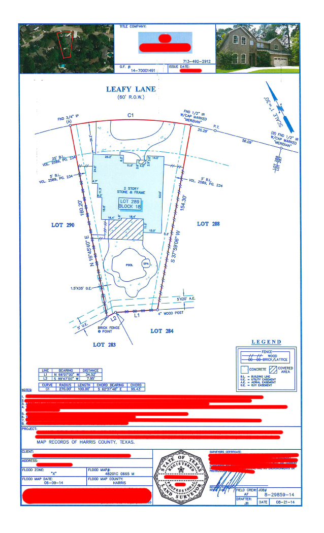
A land survey is a detailed record of the features, orientation, dimensions, boundaries and overall layout of a given piece of property, all drawn on a two dimensional map.

It is based on exact measurements taken by a surveyor and creates a legal description of the land.
A survey can tell you if the trees, driveways, bodies of water, power lines, fences and sidewalks are actually part of the property you are interested in buying.
Title Company Requirements
The title company will require a survey before they will issue the title. If the current owner already has a survey, the title company will have to review it to determine if it is acceptable (most are).
If there have been changes to the property like a converted garage or a pool, a new survey is required. If the seller does provide a survey, they must complete (and have notarized) a T-47 form (also known as a Residential Real Property Affidavit).
If the owner does not have a survey, the buyer typically pays the fee. A survey will cost around $350 in Texas.
Being able to read a survey will tell you the exact nature of the property you are purchasing.
This will help you avoid any misunderstandings (including future legal arguments over who owns what).
Examples of Texas Land Surveys:

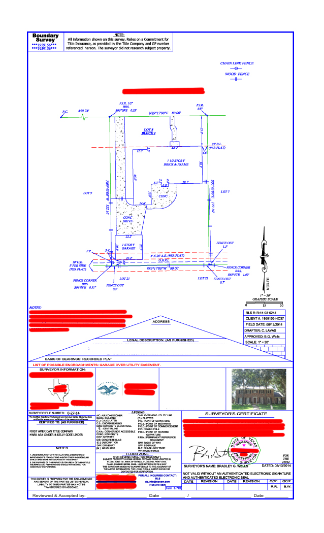

Easements
An easement states who can access or use the land (and for what).
Example: A local utility company that has to be able to get in to read a meter or even install a series of power-lines.
Easements can also allow a neighbor to walk or drive through your property in order to get to their land. Easements can be specific or general. The thing to keep in mind is that easements say who can use the property and puts limits on what you can do with it. (You can’t build something that will block access to someone who has an easement.)
Encroachments
Encroachments occur when one property owner infringes on the rights of another.
Example: If a fence is built three feet onto the adjoining land or a building is actually located partially or completely on an adjoining property. Sellers are required to tell buyers of any known encroachments.
If there are encroachments, and you are considering buying, you should proceed with caution. You might even want to seek legal counsel before going any further. Some encroachments are serious.
The Legend
The legend of a survey is the key that unlocks the meaning of all of the symbols, lines and colors of the survey.
Every line or symbol on the survey has a corresponding meaning to identify features on the land such as lakes, rivers, utility lines, elevation and depressions in the land, and even the type of vegetative growth on the land parcel, as well as boundary lines.
If the survey does not have a legend (not all do), check out the common symbols online by going to a state or federal website such as the Bureau of Land Management.
Scale
The scale tells you how the lines on the paper relate to the real world dimension of the property.
Example: A scale of 1:10,000 (1 to 10,000) means that each inch, centimeter or meter represents 10,000 inches, centimeters or meters on the actual ground.
Survey Title or ALTA Coverage
Survey title coverage or ATLA (American Land Title Association) coverage is a form of insurance that can only be issued once a survey has been completed. ALTA coverage is designed to protect the buyer from issues that they were not aware of.
Example: If you bought the land not knowing that someone else had a right to the property and had to go to court, the insurance might cover some or all of your expenses.
When you purchase the survey title (ALTA) coverage, make sure that you talk to the title company about getting an “extended” policy that has no deletions.
You should discuss all of your options with the title company to make sure that you are covered against unreported liens, mining claims, water rights, disputes over boundary lines, encroachments and other issues that you might not be aware of.
Surveys can also contain:
- Location of the land
- Names of subdivisions
- Size or acreage
- Date of the survey
- Scale bar (a bar that shows the lengths of certain lines in relation to others)
- An arrow that shows orientation (in relation to Magnetic North)
- Surveyor’s information
- Surveyor’s seal
- Plat Legend (a form of draftsman shorthand that explains what the symbols, abbreviations and lines mean)
- Easements and restrictions
- A location sketch
The best advice is always to do your homework. Make sure that you understand exactly what you are getting when you buy a home or property.
